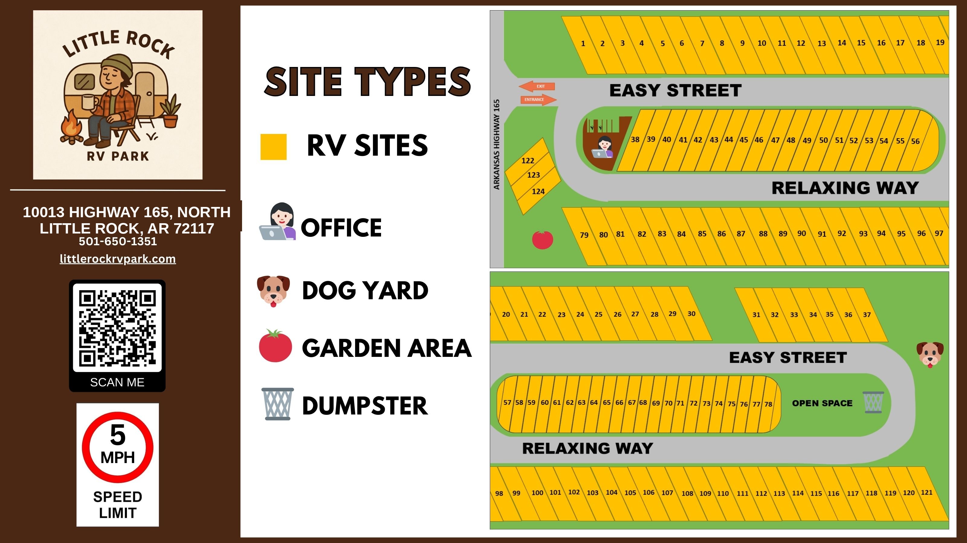
Map Legend
- RV Sites
- Office
- Dog Yard
- Garden Area
- Dumpster
- Open Space
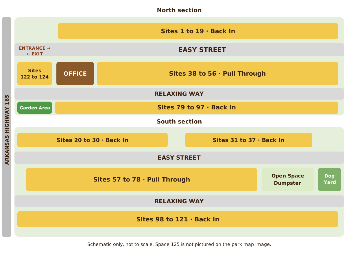
Schematic Map
This schematic is drawn from the same site data as the text guide below. It is a reading aid and is not to scale.
Park Map in Words
The park has 125 full hookup spaces on two roads, Easy Street and Relaxing Way. Arkansas Highway 165 runs along the west edge of the park. The entrance and exit are at the northwest corner, off Highway 165 at the west end of Easy Street. The map image labels spaces 1 through 124; space 125 is not pictured on the image.
Site types by number
- Back In: spaces 1 through 37 and 79 through 125
- Pull Through: spaces 38 through 78
North section
- Sites 1 to 19: the north row, with Easy Street along the south side of the row.
- Sites 122 to 124: three angled spaces just inside the entrance, between Highway 165 and the office island.
- Sites 38 to 56: the central island. Easy Street runs along the north side and Relaxing Way along the south side. The office sits at the west end of this island, near the entrance.
- Sites 79 to 97: the row south of Relaxing Way. The garden area sits just west of site 79.
South section
- Sites 20 to 30 and 31 to 37: the top row, with Easy Street along the south side of the row.
- Sites 57 to 78: the central island. Easy Street runs along the north side and Relaxing Way along the south side. Open space and the dumpster sit east of this island, and the dog yard is at the far east edge of the south section.
- Sites 98 to 121: the bottom row, with Relaxing Way along the north side of the row.
Every site has full hookups with water, sewer, and 20 amp, 30 amp, and 50 amp electric service. The speed limit is 5 mph throughout the park.
Machine readable versions of this map: park map data (JSON) · accessible schematic map (SVG)
Plan Your Perfect Stay
Our back in and pull through sites all include full hookups with water, sewer, and 20, 30 and 50 amp electric service. Reserve online or Call Us.